How Libya Built an Underground River in the Sahara: The Great Man-Made River Explained
SUMMARY OF THIS ARTICLE
- Libya found a vast store of ancient water under the Sahara by accident in 1953, while drilling for oil in the south of the country.
- The Great Man-Made River is a buried network of huge concrete pipes that carries that water hundreds of kilometres north to Libya’s coastal cities.
- The project was built in phases from the 1980s onward, and it still supplies a large share of Libya’s freshwater today.
- War, damage to wells and factories, and the fact that the water is not meaningfully refilled have put the system under serious strain.
- Its story offers lessons for other dry countries about planning, sharing water, and not treating ancient water as endless.
Introduction: A River You Cannot See
When people picture a river, they usually picture water moving across the surface of the land, between banks, under a bridge, past farms and towns. The Libya underground river Sahara story breaks that picture completely. In Libya, one of the largest water projects ever built does not look like a river at all. From above, much of it is invisible. The water travels underground, inside pipes so large that a person could stand inside some of them, across a desert where rain is rare and the sun is strong.
That project is called the Great Man-Made River. It was built to solve a simple but very hard problem. Most Libyans live near the Mediterranean coast, in cities such as Tripoli in the west and Benghazi in the east. Most of the country’s fresh water, however, was found far to the south, buried deep under the Sahara. The distance between the water and the people was hundreds of kilometres. The project tried to close that gap, not with a canal on the surface, which would lose huge amounts of water to evaporation in the desert heat, but with a sealed, buried pipeline network.
The scale is difficult to grasp at first: a network roughly 4,000 to 5,000 kilometres long, more than 1,300 wells, pipe factories built in the desert, and a cost often quoted at around $25 billion, with some estimates nearer $30 billion. It has been called the largest irrigation project in the world, and nicknamed the “Eighth Wonder of the World” — popular descriptions, not official rankings. What is not in doubt is that it changed how water reached Libyan homes, farms, and cities.
This article explains how the project works, how it was discovered and built, what war did to it, and why experts still argue about how long its water can last. Where figures differ between sources, it says so plainly.
The Accidental Discovery: Looking for Oil, Finding Water
The story begins in 1953, and it begins with a mistake of a fortunate kind. Oil teams drilling in southern Libya were looking for one valuable resource and found another. Instead of oil alone, their drills struck fresh water, deep underground, in large quantities. At the time, Libya was not yet an oil-rich state in the way it would later become, and the discovery did not immediately lead to a giant pipeline. It took years of further drilling, mapping, and study before anyone understood the full size of what lay beneath the desert.
That slow understanding matters. A single well shows water is present, but not how far it stretches, how deep it lies, or whether it can be pumped safely for decades. Geologists had to map the rock layers below the Sahara, and that picture turned out to be extraordinary: not a small pocket, but a much larger system crossing national borders, hidden under sand and stone.
The discovery also changed Libya’s question: no longer only where to find water, but how to move it from a remote desert wellfield to the coast without losing it or spending more than the country could afford. Solving that would take decades, huge factories, and thousands of workers.
The Ancient Water: The Nubian Sandstone Aquifer
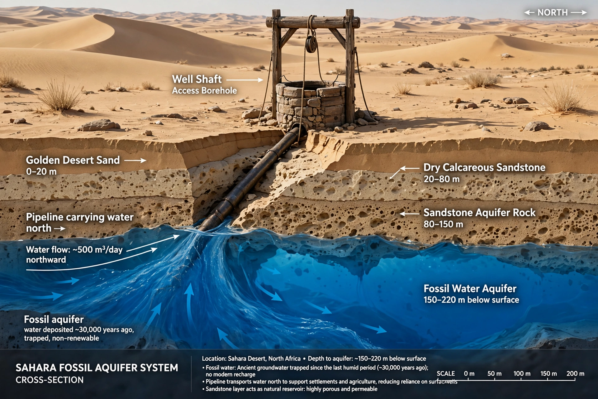
The water found in southern Libya belongs to the Nubian Sandstone Aquifer System, one of the largest known groundwater systems in the world. It lies beneath parts of Libya, Egypt, Chad, and Sudan, covering an area estimated at about 2 million square kilometres. To put that in perspective, that is larger than many countries, and it is almost entirely out of sight.
The water in this aquifer is often called fossil water. That term does not mean the water contains fossils in any everyday sense. It means the water was laid down a very long time ago, during a wetter period in the distant past, and has been stored in porous sandstone rock ever since. Estimates of its age vary, but many sources describe it as dating from the last Ice Age, tens of thousands of years old, with some estimates reaching up to around a million years for the oldest parts of the system. In practical terms, it is water from a different climate era, trapped underground.
The total volume is also described in very large numbers, commonly around 150,000 cubic kilometres, although some sources give larger figures. These should not be read as exact measurements: the aquifer is not a single underground lake, but a complex system of rock layers holding water in the spaces between grains of sandstone, at different depths and qualities. What matters is that its southern part held a great deal of fresh water, deep below a country with very little surface water.
That ancient character is the key to the project’s biggest debate. Water that fell tens of thousands of years ago is not replaced by today’s rainfall in any meaningful amount, so pumping it draws down a store built up over geological time. That does not automatically make the project a mistake, but every decision about how much to pump, and for what, carries long-term consequences.
Why Libya Needed It: A Dry Country with Coastal Cities
Libya is mostly desert. Rainfall is very low across much of the country, and in the deep south it can be almost absent for long periods. There are no large permanent rivers flowing across the Sahara to the coast in the way that, for example, the Nile flows through Egypt. Libya’s population, farms, and industry are concentrated near the Mediterranean, where the climate is milder, but even there water is limited.
That mismatch shaped daily life long before the project. Coastal cities such as Tripoli and Benghazi needed water for homes, hospitals, schools, and industry, and farmers near the coast needed it for crops. As cities grew, demand grew with them. Coastal groundwater could help for a time, but heavy pumping near the sea risks seawater moving into freshwater layers, making wells salty. Desalination was known, but it was expensive and energy-hungry at national scale.
The southern aquifer offered a different answer: bring water north in bulk, give coastal cities a more reliable supply, water farms, and ease pressure on fragile coastal groundwater. That promise explains the political attention and money it attracted. It was presented not simply as a pipeline, but as a way to make desert land productive and give Libya a measure of water independence.
It also explains why the project was so sensitive. Water is not only a technical issue. It affects where people can live, what they can grow, and how secure a city feels. A system that supplies a large share of a country’s freshwater becomes, by definition, critical infrastructure. When it works, it is easy to take for granted. When it fails, millions of people feel it within days.
How the Great Man-Made River Works: Pipes, Wells, and Gravity
So, how does the Libya underground river Sahara system work in practice? The answer starts underground, at the wellfields. More than 1,300 wells, many reaching up to about 500 metres deep, draw water from the aquifer in the south. The water is collected and sent into the pipeline network, which carries it north toward the coast. Along the way, the system includes pumping stations, storage reservoirs, and control facilities, because moving millions of cubic metres of water over hundreds of kilometres is not a passive process, even with gravity helping.
Gravity is one of the most interesting parts of the design. The southern wellfields sit at a higher elevation than the coastal cities. That height difference means that, in places, water can flow downhill through the pipes with limited pumping, helped by its own weight. This is a major reason the project could move such large volumes without the energy cost being even higher. It is important not to overstate this point, though. Gravity helps, but it does not do all the work on its own. Pumping stations are also part of the system, and the network needs power, maintenance, and monitoring to keep pressure and flow steady.
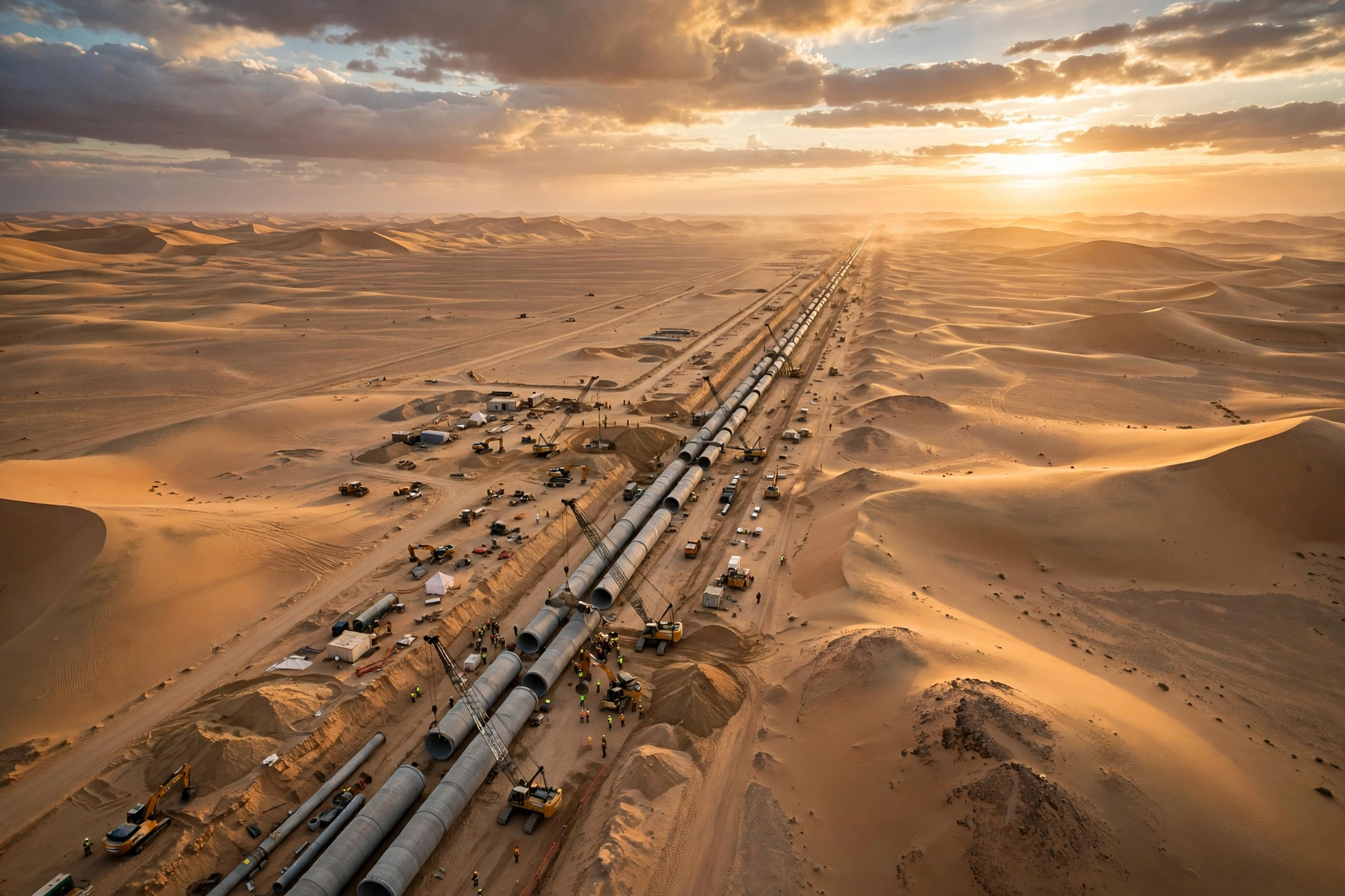
The pipes themselves are remarkable. They are made of prestressed concrete, about 4 metres in diameter and about 7 metres long per section, with each section weighing up to about 75 to 80 tonnes. That is roughly the weight of a loaded lorry, for a single pipe section. They were laid in trenches about 7 metres deep, then buried. Burying the pipes was a deliberate choice. It protected them from the desert heat, reduced evaporation to effectively zero, since the water never touched open air, and shielded the system from sand and surface damage.
The design capacity is often quoted at around 6.5 million cubic metres per day — what the system was designed to deliver, not necessarily what it delivers every day, especially after years of conflict and damage. Supplies from the project are commonly described as providing around 70 percent of Libya’s freshwater. That share explains both its importance and its vulnerability: when one system provides most of a country’s water, any interruption becomes a national problem.
Building in the Desert: Factories, Trenches, and Scale
Building a project of this size in the Sahara was, in itself, a huge undertaking. The pipes could not simply be shipped in from far away in the quantities needed, so dedicated pipe factories were built in the desert. One of the best-known facilities was at Brega, on the coast, but desert production sites were also central to the effort. These factories had to make thousands of identical, extremely heavy concrete sections to a high standard, because a weak pipe buried under the desert could fail far from any repair crew.
Transport was another challenge: moving a 75-tonne pipe section across sand, into a 7-metre trench, and joining it precisely to the next section, repeated thousands of times, required cranes, specialised vehicles, and careful planning, in heat, dust, and far from established towns.
The timeline reflects that difficulty: the project was built in phases over decades, each adding wellfields, pipeline sections, and cities. Each completed phase could begin delivering water while the next was planned, but the full system was never truly finished like a single building, and further planned phases were interrupted by war and political change.
For readers today, the construction story is a reminder that megaprojects are not only about the final structure, but about logistics: making materials, moving them, housing workers, and keeping quality steady over thousands of kilometres.
Phases and Cities Served: From Benghazi to Tripoli and Beyond
The Libya underground river Sahara project was launched in the 1980s, and its phases tell the story of how water gradually reached more of Libya. Phase I was aimed at the east, carrying water toward Benghazi and Sirte, and became operational in 1991. For people in those cities, that was the moment the abstract idea of desert water became taps, farms, and a more secure supply. Phase II turned west, toward the capital, Tripoli, and became operational in 1996. That phase mattered enormously, because Tripoli is Libya’s largest city and its political and economic centre.
Phase III, completed in 2009, extended the system further and added Tobruk, in the far east, to the network. Together, these phases created a system that linked southern wellfields to a string of coastal destinations, with branch lines and reservoirs serving towns and farming areas along the way. The network’s total length, roughly 4,000 to 5,000 kilometres depending on how branches and later additions are counted, reflects that branching structure rather than a single straight pipe from south to north.
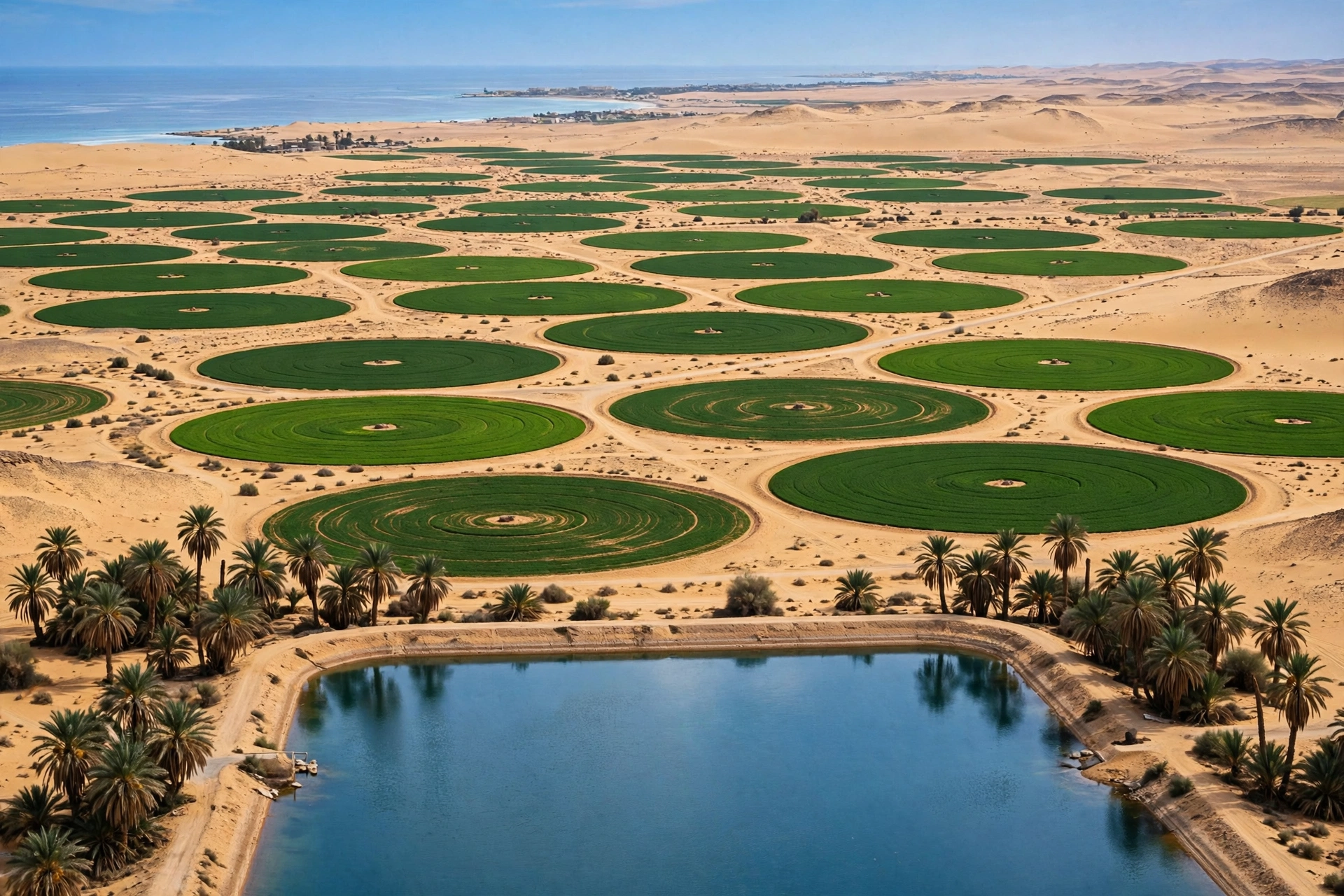
The project did not only supply drinking water. It also supported agriculture, including new farming areas that would have been impossible without a reliable source. Green desert fields became one of its most powerful images. That matters for sustainability, because farming uses far more water than household use alone, so decisions about farm water and crops directly affected how fast the ancient store was drawn down.
The phased history also shows why the project is sometimes described as incomplete. Plans for further phases, to reach more areas and increase capacity, existed on paper, but Libya’s political turmoil after 2011 changed priorities, damaged infrastructure, and made large new construction far harder. The system that exists today is therefore best understood as a large, working, but unfinished and damaged network, rather than a completed monument.
War and Damage: When Water Became a Target
No honest account of the Great Man-Made River can skip the damage it suffered. In 2011, during the conflict that ended the rule of Muammar Gaddafi, the Brega pipe plant was hit in a NATO air strike. NATO said at the time that rockets and military material were stored there. That claim was disputed by others, who argued the plant was a civilian water facility. The dispute itself is part of the story, because it shows how easily critical water infrastructure can become entangled in war, and how hard it can be, after the fact, to establish exactly what was in a building at the moment it was struck. What is clear is that a facility central to making and repairing the project’s pipes was damaged in wartime.
The damage did not stop in 2011. During the wider conflict from 2014 to 2020, wells, pumping stations, and other parts of the water system were damaged, seized, or shut down at various times. Armed groups understood the power of controlling water, and in a country where one system supplies most freshwater, cutting that supply could put pressure on whole cities. At times, water was cut to millions of people, not because the aquifer had run dry, but because the infrastructure to move the water had been broken or blocked.
That distinction is important: the aquifer still held water, but people could not get it. A pipeline system is only as strong as its weakest station, valve, or power supply, and when repair crews cannot safely reach a site, a local failure can become a regional crisis. For families in Tripoli or Benghazi, taps ran dry and water had to be trucked in or bought.
The war years also interrupted maintenance. A buried pipeline needs inspection and repair even in peacetime, and years of conflict, divided authority, and limited funding made that routine work far harder. The system emerged weaker, less reliable, and in need of investment that has been difficult to secure.
Will the Water Run Out? The Sustainability Debate
The most argued question about the Great Man-Made River is also the simplest to ask: will the water run out? The honest answer is that nobody can give a single settled date, because the answer depends on how much water is pumped, for what, and how the aquifer behaves over decades. Experts give widely different estimates, and this article presents them as a range, not as a prediction.
Some estimates, based on higher rates of use, suggest the usable supply could last on the order of 60 to 100 years. Others, based on lower rates of use, stretch far longer, into centuries, and some estimates reach around 1,000 years at the rates seen around 2007. Officials in Libya have at times quoted a figure of around 650 years. Those numbers are not all describing the same thing. Some count only the portion of the aquifer that is easiest to reach, or only Libya’s share, while others count the whole system. Some assume current pumping continues unchanged, while others assume it grows or falls. That is why the range is so wide, and why any article that gives a single year for “running out” should be treated with caution.
What is not seriously disputed is the basic point: fossil water is not meaningfully replenished by today’s rain. The Sahara’s rainfall is far too low, and the rock layers are too deep, for the aquifer to refill on human timescales. Pumping therefore reduces the store, even if slowly. That makes management, not just engineering, the central issue. If water is used mainly for drinking and essential needs, the store lasts far longer than if large amounts are used for water-hungry farming in the desert, or lost through leaks and poor maintenance.
There is also a shared dimension: the aquifer lies under four countries, not one, so water pumped in Libya can affect, over long timescales, the system Egypt, Chad, and Sudan also draw on. In 2013 the four countries agreed a framework for cooperation, a step toward joint monitoring. No single country can manage a cross-border aquifer alone, so the project’s future is a regional question, not only a Libyan one.
For ordinary readers, the useful takeaway is not a countdown, but a question: is the water being used at a rate future generations can also live with, and is anyone measuring the aquifer carefully enough to know?
What Other Dry Countries Can Learn
Other dry countries watch projects like this closely, because many face the same basic problem: people and farms are in one place, water is in another, and rainfall is unreliable. The Great Man-Made River offers several lessons, both positive and cautionary.
First, engineering can solve the distance problem. Burying pipes, using gravity where the land allows, and building at scale can move water across a desert with very little loss to evaporation. That is a real achievement, and it is why the project is still studied by engineers. Second, scale brings risk. When one system provides around 70 percent of a country’s freshwater, protecting that system, in peacetime and in war, becomes a national security issue, not just a maintenance task. Diversifying sources, so that no single failure leaves millions without water, is a lesson many water planners now stress.
Third, desalination deserves a fair comparison. It is expensive and energy-hungry, which is why Libya did not rely on it alone, but technology has improved and costs have fallen in some places. For coastal cities, a mix of sources — desalination, treated wastewater reuse, conservation, and groundwater — may be more resilient than a single giant pipeline.
Fourth, conservation matters as much as supply. Fixing leaks, water-efficient farming, dry-climate crops, and pricing that discourages waste can extend an aquifer’s life by decades, often delivering more water per unit of money than new construction.
Finally, shared water needs shared rules. The 2013 framework among Libya, Egypt, Chad, and Sudan points in the right direction. Dry countries that share an aquifer, a river, or a coastline need agreements on monitoring, on how much each country pumps, and on what happens in a drought. Without those agreements, each country has an incentive to pump more now, even if that harms everyone later. Libya’s story shows both why such agreements are hard, and why they are necessary.
Frequently Asked Questions
What is the Great Man-Made River?
It is Libya’s large, buried pipeline network that carries fresh water from deep wells in the southern Sahara north to coastal cities and farming areas. It is not a natural river on the surface. It is an engineered system of wells, pipes, pumping stations, and reservoirs, built in phases from the 1980s onward.
How does the Libya underground river Sahara system actually move water?
Water is pumped from wells up to about 500 metres deep in the south, then carried through huge prestressed concrete pipes buried about 7 metres underground. Because the southern wellfields are higher than the coast, gravity helps the water flow north in places, while pumping stations keep the flow steady across the whole network.
Why is it called the “Eighth Wonder of the World”?
That nickname reflects its scale and ambition: thousands of kilometres of giant pipes, more than 1,300 wells, desert factories, and a cost often quoted around $25 billion. It is a popular nickname, not an official title, and it is best understood as a way people expressed amazement at the engineering, rather than a formal ranking.
How long will the water last?
There is no single agreed answer. Estimates range widely, from around 60 to 100 years at higher rates of use, to centuries, and in some estimates around 1,000 years at 2007 rates, with officials having quoted around 650 years. The range depends on how much is pumped, for what purpose, and which part of the aquifer is counted. Because the water is fossil water and is not meaningfully refilled by today’s rain, careful management matters more than any single date.
Can other countries copy this project?
They can learn from it, but copying it exactly is rarely the best choice. The project depended on a very large, high-quality aquifer, a height difference that allowed gravity to help, and huge investment over decades. Other dry countries may get better results from a mix of sources, including conservation, desalination where it makes sense, wastewater reuse, and shared management of any aquifer they use.
Closing: A River Buried, A Lesson Above Ground
The Great Man-Made River remains one of the most striking stories in the history of water engineering. A country with almost no permanent rivers found ancient water by accident, mapped a vast aquifer hidden under the Sahara, and built a buried river to carry that water to its cities. For millions of Libyans, that system has meant drinking water, farms, and a degree of security that would have been hard to imagine without it.
It is also a story with a warning built into it. Ancient water is a gift from a wetter past, not a permanent income. War showed how fragile even the strongest concrete can be when it becomes a target. And the wide range of estimates for how long the water will last shows how much we still do not know, and how important it is to measure, maintain, and share water carefully.
If this story teaches one thing, it is this: the hardest part of a water project is not always building it, but keeping it working, fairly and carefully, for the generations who will need it after the builders are gone.