How Does GPS Know Where You Are?
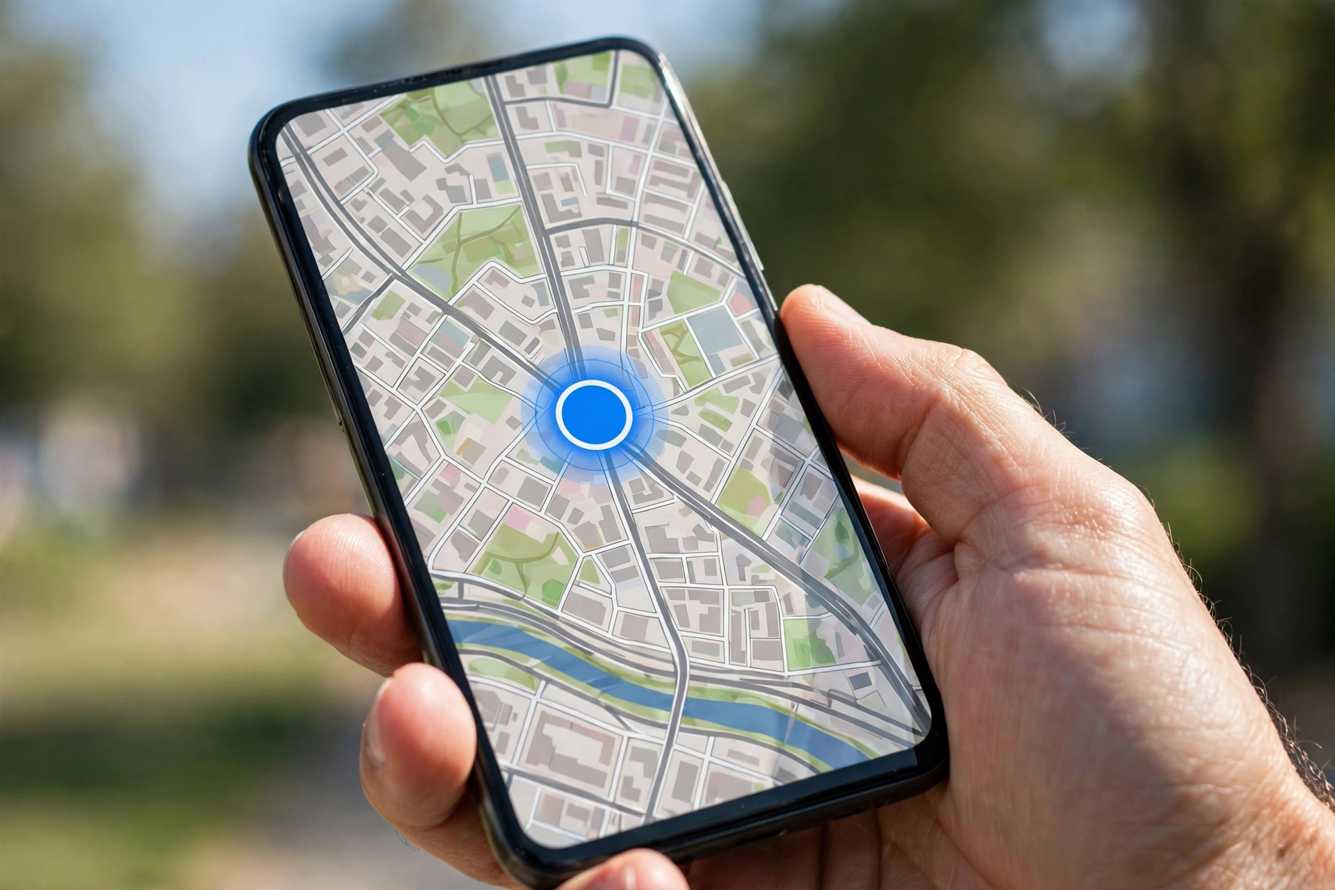
You open the map app on your phone. A small blue dot shows up. That dot is you. It moves when you move. It knows which street you are on. It knows which way you are facing. But how does it know?
Your phone cannot see you. It has no eyes. It does not ask you where you are. It works out your spot on Earth by listening to machines far above your head. Those machines are satellites. They fly around our planet all day and all night. They send out radio signals. Your phone listens to those signals and does some simple maths. That is the whole trick.
GPS is short for Global Positioning System. It helps you find your place on Earth. It works in almost every country. It works in cars, on planes, on boats, and on foot. It is free for anyone with a phone or a GPS device. In this article, we will explain how it works in the simplest way we can. You do not need to know maths or science to follow along.
SUMMARY OF THIS ARTICLE
- GPS is a system of about 24 satellites that fly high above Earth and send out radio signals all the time.
- Your phone listens to those signals and works out how long each one took to reach you.
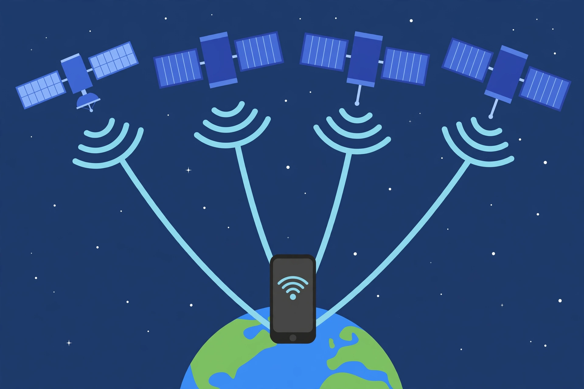
- By using signals from at least 4 satellites, your phone can work out where you are on the map.
- GPS needs a clear view of the sky, so it can be weak or wrong inside tunnels and between very tall buildings.
- The map in your app and your GPS location are two different things that work together to guide you.
GPS in One Sentence
Here is GPS in one short sentence: your phone listens to signals from satellites in space, works out how far away each satellite is, and uses that information to find your exact spot on Earth.
That is it. There is no magic. There is no camera watching you from space. The satellites do not track you. They do not know who you are. They only send out signals, like a radio station sends out music. Your phone does the listening and the thinking. The satellites never hear anything back from you.
Satellites High Above Earth
The GPS system uses about 24 main satellites. They fly in a ring around Earth, high up in space. They are about 20,000 kilometres above the ground. That is very far away. A plane flies about 10 kilometres high. These satellites fly about 2,000 times higher than a plane.
Why so high? Because from up there, each satellite can “see” a huge part of Earth at once. With about 24 satellites spread out around the planet, almost every spot on Earth can always “hear” at least 4 satellites at any time. Four is the smallest number your phone needs to find you. We will explain why in a moment.
These satellites never stop moving. They circle Earth about twice every day. They move fast, at about 14,000 kilometres per hour. But they are so far away that you cannot see them with your eyes.
Each satellite carries a very exact clock, called an atomic clock. It is far more exact than any clock in your home. This exact time matters a lot, as you will see. Each satellite also knows exactly where it is in space at every second. It sends out a signal that says two things: “Here is the exact time” and “Here is where I am right now.”
The satellites were first built for the military in the United States. Later, the system was opened up for everyone to use. Today, GPS is free for all of us. It helps drivers, pilots, sailors, hikers, farmers, and ordinary people with phones.
How Your Phone Listens to Satellite Signals
Your phone has a small GPS receiver inside it. A receiver is a part that listens for radio signals. You cannot see it. It is built into the phone, just like the part that connects to Wi-Fi or to mobile data.
Radio signals travel at the speed of light. That is about 300,000 kilometres per second. It is the fastest speed we know. A signal from a GPS satellite reaches your phone in a tiny fraction of a second, even from 20,000 kilometres away.
Here is the clever part. Each satellite sends out its signal at a known time, and the signal carries a special code. Your phone knows this code too. When the signal arrives, your phone can tell how late it is. Since radio waves move at a known speed, your phone can work out the distance. Distance equals speed times time. If you know how fast something moves and how long it moved for, you know how far it went.
Let us use a simple example. Imagine a radio signal moves at 300,000 kilometres per second. If the signal took one tenth of a second to reach your phone, then the satellite is about 30,000 kilometres away. Your phone does this maths in a flash, many times every second.
Your phone does not need to talk back. It only listens. That is why GPS does not use your mobile data. The listening part uses a small amount of power. The part that uses more power is the map app itself, which draws the map and talks to the internet to load streets and places.
Timing: Measuring How Long Each Signal Took
Time is the heart of GPS. Everything depends on measuring time very, very well. A radio signal moves at the speed of light, which is about 300,000 kilometres per second. That is so fast that even a tiny error in time makes a big error in distance. If your phone’s clock is wrong by just one thousandth of a second, the distance it works out will be wrong by about 300 kilometres. That is a huge mistake. Your phone would think you are in a different city.
This is why the satellites carry atomic clocks. These clocks are so exact that they are wrong by less than one second in millions of years. Your phone does not have an atomic clock. Its clock is a normal clock, and it is not that exact. So how does your phone still get the right answer?
The trick is that your phone does not trust its own clock alone. It uses the satellites to fix its own clock. When your phone listens to four satellites at once, it can work out four things at the same time: your position north to south, your position east to west, your height above the ground, and the error in its own clock. The maths sorts out all four at once.
To understand this better, imagine four friends who each shout your name at a set time, but your watch is slow by two seconds. If you only listened to one friend, you would get the distance wrong. But if you listen to all four friends, you can spot the pattern. All four shouts seem late by the same amount. That tells you your watch is wrong, not that your friends are farther away. Your phone does the same kind of thinking with satellite signals.
This is also why GPS needs at least four satellites. Three satellites can tell your phone where you are on a flat map, but they cannot tell your height and fix the clock error at the same time. The fourth satellite gives your phone the extra piece it needs. With four or more satellites, the answer becomes solid and exact. Most of the time, your phone can hear far more than four satellites — often eight, ten, or even more. The more satellites it hears, the better the answer gets.
Triangulation with 4 Satellites, Simply
The word for how GPS finds you is triangulation. It sounds like a hard word, but the idea is simple. Let us break it down with an easy picture.
Imagine you are lost in a town. You know you are 5 kilometres from the library. That alone does not tell you where you are. You could be 5 kilometres north of the library, or south, or east, or west. You could be anywhere on a circle around the library.
Now you learn you are also 3 kilometres from the school. That narrows it down. There are only two spots that are both 5 kilometres from the library and 3 kilometres from the school. You are at one of those two spots. Now you learn you are 4 kilometres from the park. That gives you the answer. Only one spot is 5 kilometres from the library, 3 kilometres from the school, and 4 kilometres from the park. That spot is where you are standing.
GPS does the same thing in three dimensions, not just on a flat map. Each satellite tells your phone how far away it is. With one satellite, your phone knows you are somewhere on a big sphere around that satellite. With two satellites, it narrows it down to a circle. With three satellites, it narrows it down to two points. With four satellites, it picks the right point and fixes the clock error too.
Why GPS Needs a Clear View of the Sky
GPS signals come from space. They travel down through the air to your phone. For the signals to reach your phone cleanly, there needs to be a clear path between the sky and your phone. This is why GPS works best outdoors, under an open sky.
Walls, roofs, and thick concrete can block or weaken the signals. That is why GPS often struggles inside buildings. When you are inside a shopping centre or a tall office block, your phone may still show a blue dot, but it may be in the wrong place or jump around. The signals bounce off walls and roofs, so they take longer paths to reach your phone. A longer path looks like a longer distance to your phone, so the answer goes wrong.
Trees can also weaken the signal a little, but not as much as concrete. Clouds and rain do not block GPS much at all. The signals pass through clouds easily.
The hardest places for GPS are deep valleys between very tall buildings. In a city with tall towers on both sides of a narrow street, your phone can only see a small strip of sky. It may hear only a few satellites, or it may hear signals that have bounced off the buildings. These bounced signals are called multipath signals. They take a longer path than the direct signal, so they confuse your phone. The blue dot may jump to the wrong street or show you walking through a building.
GPS vs Maps Apps: The Map Is Separate from the Location
Many people think the map app and GPS are the same thing. They are not. They are two different tools that work as a team.
GPS is the part that finds your location. It tells your phone, “You are here.” It gives your phone a pair of numbers: your latitude and your longitude. Latitude tells you how far north or south you are. Longitude tells you how far east or west you are. Together, they point to one spot on Earth.
The map app is the part that shows you streets, shops, parks, and roads. It takes the numbers from GPS and puts a blue dot on the right place on the map. Without GPS, the map app would still show you the map, but it would not know where you are on it. Without the map app, GPS would still know your numbers, but you would not be able to see them as streets and places.
Another common mix-up is between GPS and the internet. GPS does not need the internet to find your location. The satellites send their signals straight to your phone. You can turn off your mobile data and your Wi-Fi, and GPS will still work. What needs the internet is the map itself. The map app needs to download the streets and pictures of the area. If you have no internet, the map may be blank or old, but GPS will still know your numbers. Some map apps let you download maps in advance so you can use them with no internet at all.
When GPS Is Wrong
GPS is very good, but it is not perfect. Sometimes the blue dot is in the wrong place. Sometimes it jumps around. Sometimes it shows you on a different road. Here are the most common reasons why.
Tunnels are the first problem. When you drive into a tunnel, the rock and concrete above you block the sky. Your phone cannot hear the satellites at all. For a short tunnel, the map app will guess your position by your speed and the last place it knew. When you come out the other side, GPS finds the satellites again and the dot jumps back to the right place. This is normal.
Tall buildings are the second problem. In a city centre with towers on every side, the signals bounce off glass and steel. Your phone hears echoes. The dot may jump across the street or into a building next door. This is worse when the buildings are very tall and the street is narrow.
Bad weather is a smaller problem. Heavy rain, thick snow, or a strong storm can weaken the signal a little. In most cases, GPS still works fine in rain. But very heavy storms can make the position less exact for a short time. It is rare for weather alone to make GPS stop working.
There are other small causes too. If your phone is deep inside a bag or under a metal roof, the signal may be weaker. If you are in a car with a heated windscreen that has metal in it, the signal may drop a little.
Sometimes the problem is not GPS at all. It is the map. If the map is old or the road has changed, the blue dot may look wrong even when GPS is right. A new road may not be on the map yet. A closed road may still show as open. In that case, GPS is telling the truth, but the map is out of date.
GPS in Everyday Life
GPS is now part of daily life for billions of people. We use it so often that we forget it is there. Here are some of the ways it helps us every day.
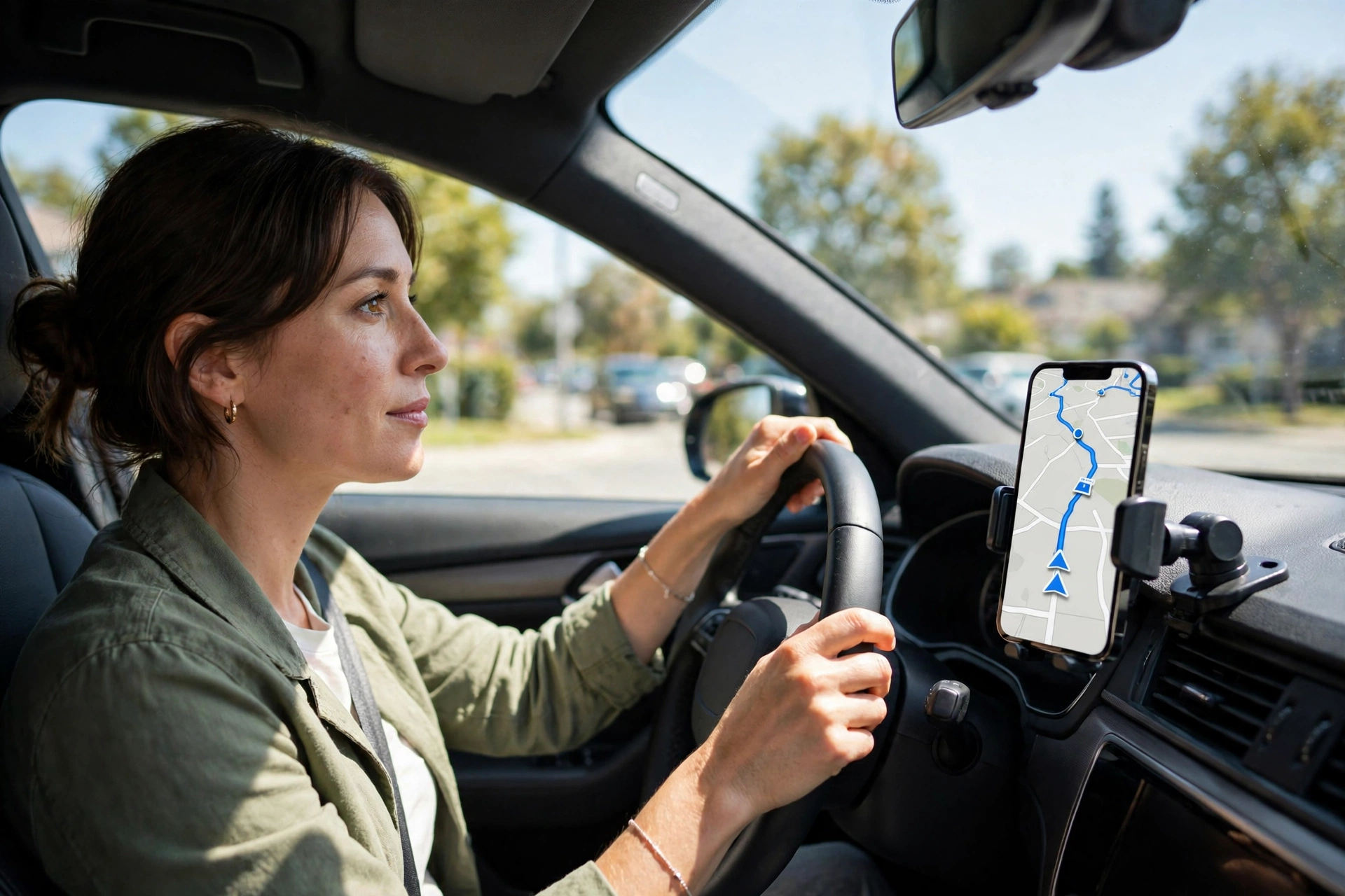
Driving is the biggest use. When you drive to a new place, the map app gives you turn-by-turn directions. It tells you when to turn left or right. It warns you about traffic ahead. It works out a new route if you miss a turn. All of this starts with GPS. Without it, the app would not know where your car is or which way it is moving.
Running and walking are another big use. Fitness apps use GPS to track your run or your walk. They measure how far you went, how fast you went, and which path you took. They can show you a map of your route when you finish.
Finding a lost phone is a use many people are thankful for. If you lose your phone, you can use another device to find it on a map. The lost phone uses GPS to report its place. You can make it ring, lock it, or erase it from far away. This only works if the phone is on and has a connection, but GPS is the part that finds it. The same idea helps parents keep track of a child’s phone and helps companies track their delivery vans.
GPS also helps in ways you may not notice. Farmers use GPS to drive tractors in straight lines across fields. Pilots use it to fly planes safely. Ships use it to cross oceans. Rescue teams use it to find people lost in mountains or at sea.
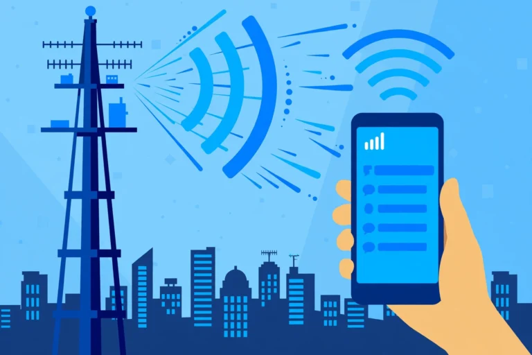
Newer phones also use a faster form of location that mixes GPS with 5G and Wi-Fi. The 5G network can help your phone find its place more quickly in a city. But GPS is still the main tool. It works almost everywhere on Earth, even far from any tower or town. That is its great strength.
A Simple Diagram in Words
Let us put the whole process together in five easy steps.
Step one: about 24 satellites circle Earth, about 20,000 kilometres above the ground. Each one sends out a radio signal all the time. The signal says what time it is and where the satellite is.
Step two: your phone listens. Its GPS receiver picks up signals from at least four satellites at once. Most of the time it hears many more.
Step three: your phone measures how long each signal took to travel. Since radio waves move at the speed of light, the travel time tells your phone how far away each satellite is.
Step four: your phone uses triangulation. It combines the distances from four or more satellites to work out your spot on Earth, your height, and the small error in its own clock.
That is all there is to it. No one is watching you. No camera is following you. It is just signals, clocks, and maths, working together in less than a second.
Frequently Asked Questions
Does GPS need the internet to work?
No. GPS finds your location using radio signals from satellites. It does not need mobile data or Wi-Fi. What needs the internet is the map itself. The map app needs to download streets and pictures. If you download the map in advance, you can use GPS and the map with no internet at all.
Why does GPS take a few seconds to start?
When you open a map app, your phone needs a moment to find the satellites and work out your spot. This is why the blue dot sometimes jumps around for a moment when you first open the app. It is still working out where you are. In an open area with a clear sky, it usually takes only a few seconds.
Can GPS work inside a building?
It works poorly inside buildings. Walls and roofs block or weaken the signals from the satellites. Your phone may still show a location, but it may be wrong or jump around. Inside, your phone often uses Wi-Fi networks and mobile towers to guess your place instead. That guess is usually good enough to show which building you are in, but not which room.
Is GPS free to use?
Yes. GPS is free for everyone. You do not pay to use the satellites. You only pay for your phone and your map app, if the app itself costs money. Most map apps are free. There is no fee per use and no limit on how often you can use GPS.
Can someone track me with GPS?
GPS itself does not track you. The satellites only send signals out. They never receive anything from your phone. But an app on your phone can record your GPS location and share it with others, if you give it permission. That is why you should check which apps can see your location in your phone settings. You can turn off location access for any app you do not trust.
How exact is GPS?
In a clear open area, GPS can often tell where you are to within about 5 metres. That is about the length of a large car. In a very good spot, it can be even closer, within about 3 metres. These numbers are approximate. They change with the weather, the place, and the phone. In a city with tall buildings or inside a tunnel, the answer can be much less exact.
More from Zorium Daily
- QR Code — What Is a QR Code and How Does It Work?
- 5G — What Is 5G and Why Is It Faster?
- Earbuds — How Do Noise-Cancelling Earbuds Work?
- Technology — More stories from the Technology category